


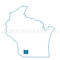
MIFFLIN - T 2 Voting District, Iowa County, Wisconsin
About
Outline

Summary
| Unique Area Identifier | 694091 |
| Name | MIFFLIN - T 2 Voting District |
| County | Iowa County |
| State | Wisconsin |
| Area (square miles) | 6.79 |
| Land Area (square miles) | 6.79 |
| Water Area (square miles) | 0.00 |
| % of Land Area | 100.00 |
| % of Water Area | 0.00 |
| Latitude of the Internal Point | 42.93395710 |
| Longtitude of the Internal Point | -90.37112680 |
Maps


Graphs
Select a template below for downloading or customizing gragh for MIFFLIN - T 2 Voting District, Iowa County, Wisconsin


Neighbors
Neighoring Voting District (by Name) Neighboring Voting District on the Map
- CLIFTON - T 1 Voting District, Grant County, WI
- EDEN - T 1 Voting District, Iowa County, WI
- LINDEN - T 2 Voting District, Iowa County, WI
- LINDEN - T 3 Voting District, Iowa County, WI
- MIFFLIN - T 1 Voting District, Iowa County, WI
- WINGSVILLE - T 1 Voting District, Grant County, WI
Top 10 Neighboring County Subdivision (by Population) Neighboring County Subdivision on the Map
- Linden town, Iowa County, WI (847)
- Mifflin town, Iowa County, WI (585)
- Clifton town, Grant County, WI (385)
- Wingville town, Grant County, WI (357)
- Eden town, Iowa County, WI (355)